My Tenth Blog Post
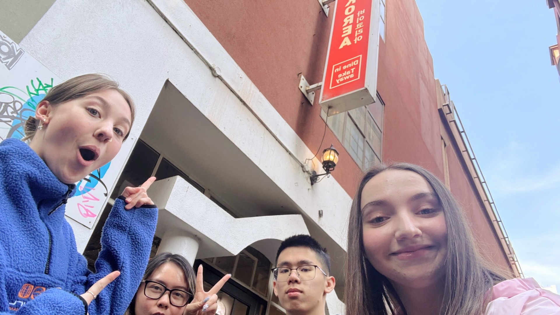
Wayfinding Activity
In this lesson we learnt about guiding navigation in relation to our 3D digital environments and how the path, thresholds and wayfinding contribute to the users experience through the environment. For the activity, as a group of 4, we were tasked to find our way together in the city to a specific location which was a restaurant. After checking where the location of the restaurant was on Google Maps for 5-10 minutes and attempting to remember streets and familar buildings, we set off together in search of the restaurant. A selfie was taken to document our achievement of discovery, navigating as group.
Photo
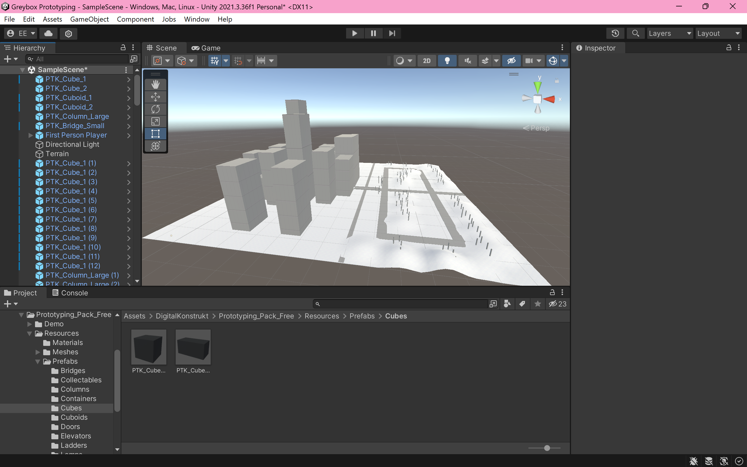
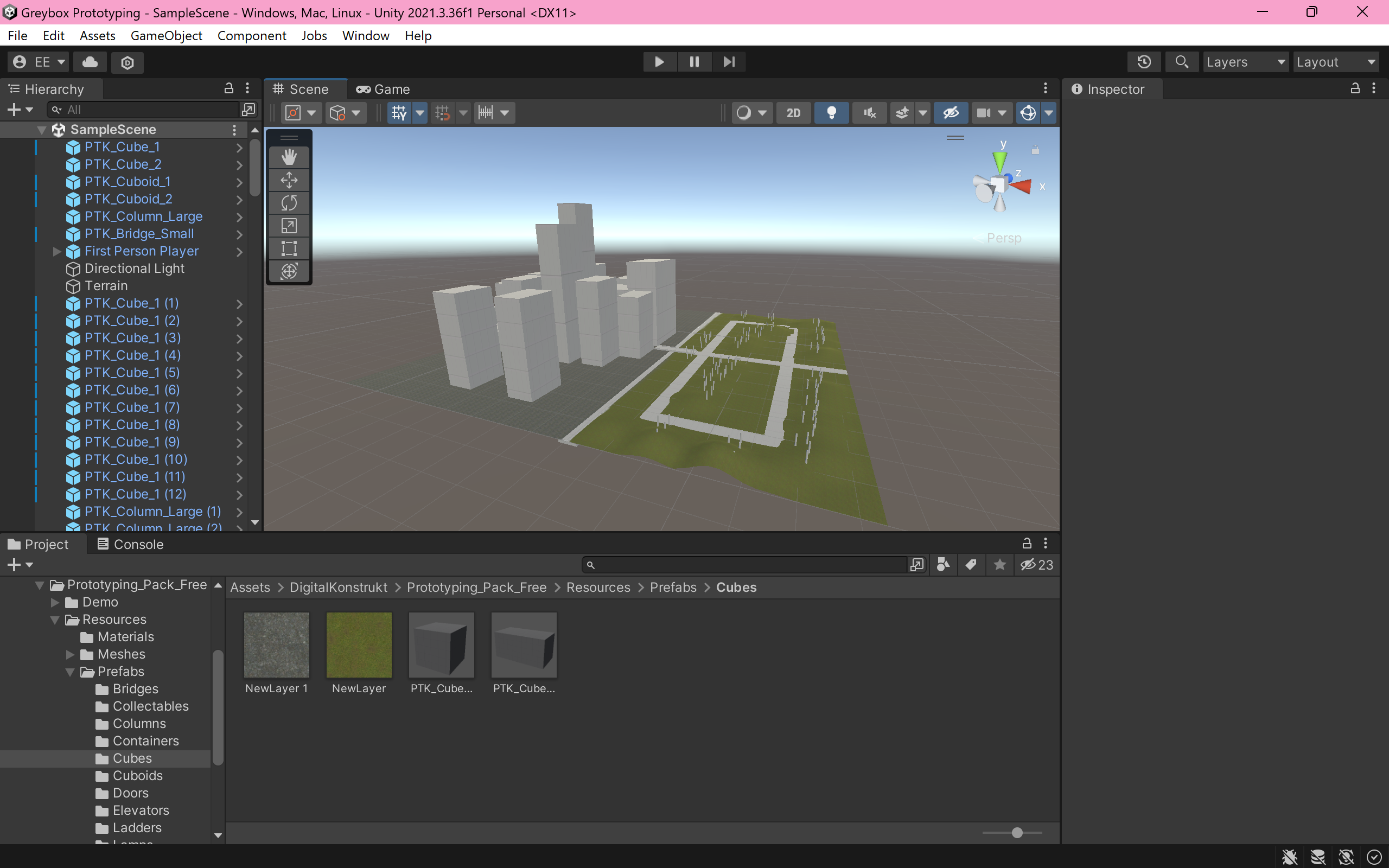
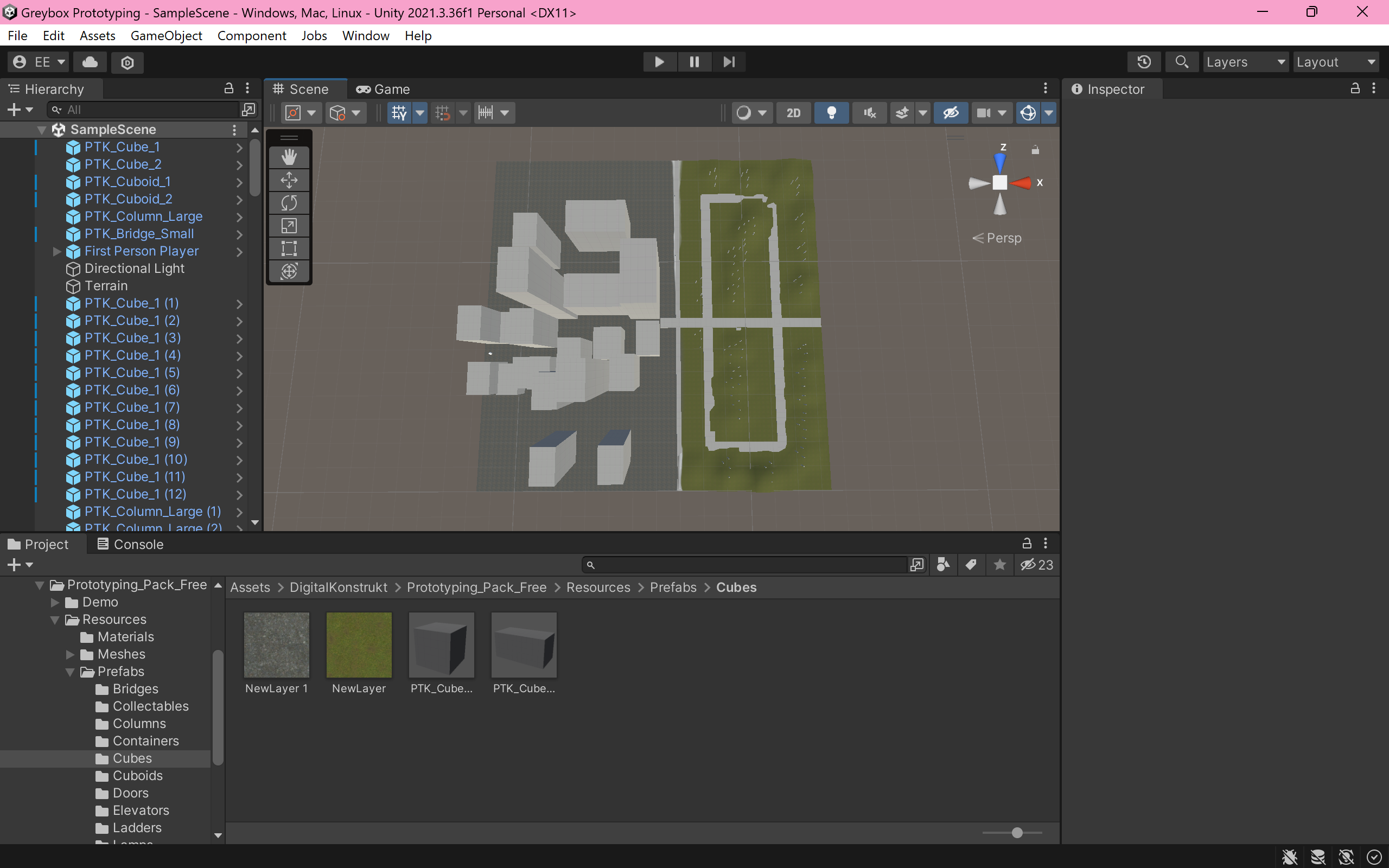
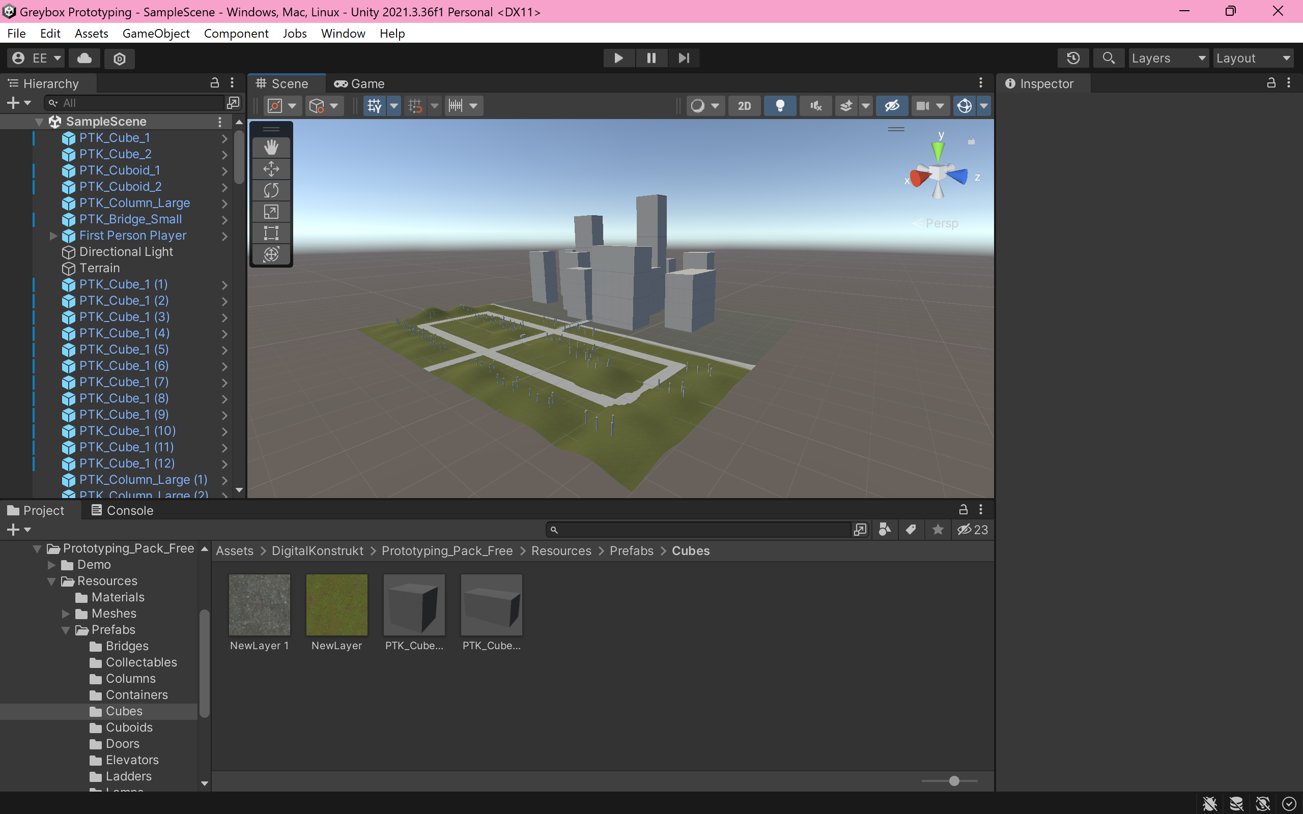
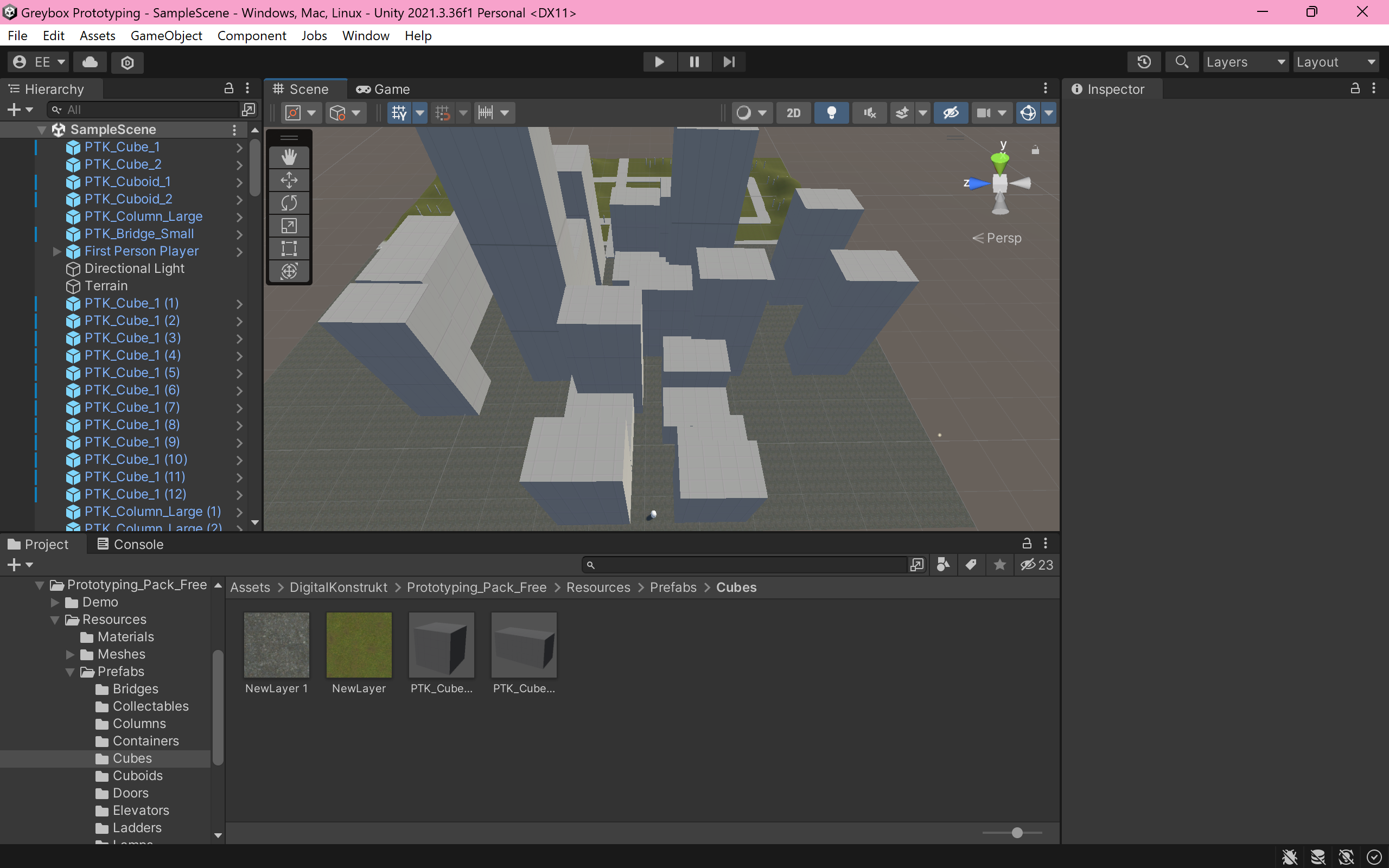
Greybox Prototype
My greybox prototype was constructed based on my drawn environment map concept. I used a range of cubes, cuboids and columns, to establish paths and structures. I also generated the raised terrain areas using the terrain tool. In order to distingush differences between the two environments, I painted one side of the terrain green to signify grass compared to the grey cement texture of the city terrain.
Screenshots